




What’s new in the 3-GIS Utilities 5.6 release
Utility operations depend on connected systems, reliable data, and tools that keep pace with the work happening across the organization. With the...



Faster installs depend on more than speed. Watch how connected orders, field work, and network records keeps Waterloo Fiber moving from request to activation.

Inspection findings should not sit in reports. Watch how Modesto Irrigation District moves field findings into repair assignments teams can act on.
2 min read

Editor’s note: Originally published by SSP Innovations under SSP Productivity. Updated by the 3-GIS Team with the current product name, 3-GIS | Productivity, and other revisions.
The way utilities manage data today reflects more than a century of innovation shaped by the pursuit of customer service and safety. From handwritten notes on paper maps to advanced tools that calculate restoration times during outages, the methods have changed but the goals remain the same.
With digital transformation, utilities can meet those goals with greater accuracy and efficiency by streamlining workflows and business processes. Gartner defines digital transformation broadly, covering everything from IT modernization to digital optimization.1 At the center of this shift are GIS platforms like Esri and solutions like those offered by 3-GIS, which provide the foundation for many utilities’ transformation strategies.
The Open Group Architectural Framework (TOGAF) outlines four architecture domains: business, application, data, and technical.2 These domains help define where transformation begins and where it should lead. 3-GIS | Productivity, for example, extends Esri’s Utility Network and plays a role in each of these domains, making it a true catalyst for organizational change.3
3-GIS | Productivity runs on the Esri ArcGIS platform and becomes part of the system of record. Productivity leverages the Utility Network data model to run analyses such as tracing, which allows users to identify open switches or valves in a network or to perform a mass phase change.
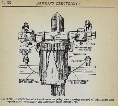
The legacy geometric network gave way to the digital transformation of the Utility Network. By using a tool that extends Esri’s core capabilities and stays true to its mission of interconnected models and digital representations of real-world assets, organizations gain agility, flexibility, and alignment with evolving technologies that maintain and power our energy infrastructure. An example of how transformation has evolved can be seen in the historic drawing below from Hawkins (1914).
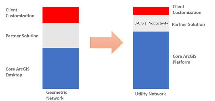
Figure 1: Geometric Network to Utility Network Digital Transformation with 3-GIS | Productivity
Figure 2: Transformer and Attachment from Hawkins Electricity (1914)
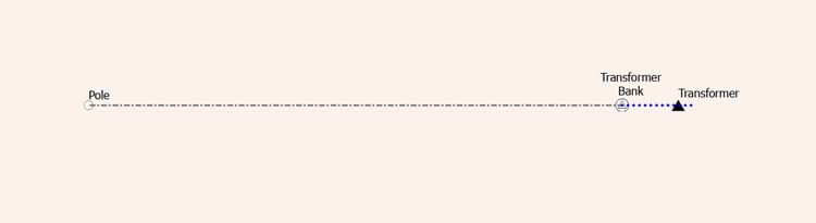
This hand-drawn illustration shows the installation of a transformer on a pole, with the method of attachment and the routing of primary and secondary leads. With Esri’s Utility Network and 3-GIS | Productivity, a similar visual representation is possible using the visual association tool.
Figure 3: 3-GIS | Productivity Visual Associations
Several technical applications from the legacy representation can now be transformed into a modern system. This example shows how structural attachment associations are visualized in 3-GIS | Productivity. Over the years the target has remained constant, but the medium we use to reach it has advanced.
Looking to strengthen your Utility Network setup? Contact us here.
Citations:
1 Gartner. “Digital Transformation.” Accessed January 23, 2026. https://www.gartner.com/en/information-technology/topics/digital-transformation
2 The Open Group. “The TOGAF Standard.” Accessed January 23, 2026. https://www.opengroup.org/togaf
3 Esri. “What Is a Utility Network?” Accessed January 23, 2026. https://pro.arcgis.com/en/pro-app/latest/help/data/utility-network/what-is-a-utility-network-.htm.
Utility operations depend on connected systems, reliable data, and tools that keep pace with the work happening across the organization. With the...
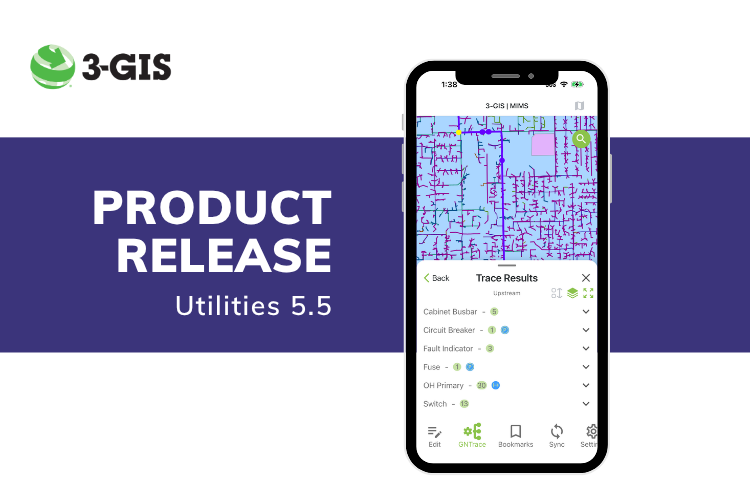
The Utilities 5.5 release brings a set of updates across both 3-GIS | MIMS and 3-GIS | Productivity, spanning field workflows and GIS-based network...

HUNTSVILLE, AL — 3-GIS today confirmed its expanded market position, now serving both telecom and utility providers with intelligent, cloud-based...