


Data validation
Apply business rules and validation workflows that help improve the quality, completeness, and usability of pole, span, and attachment data.
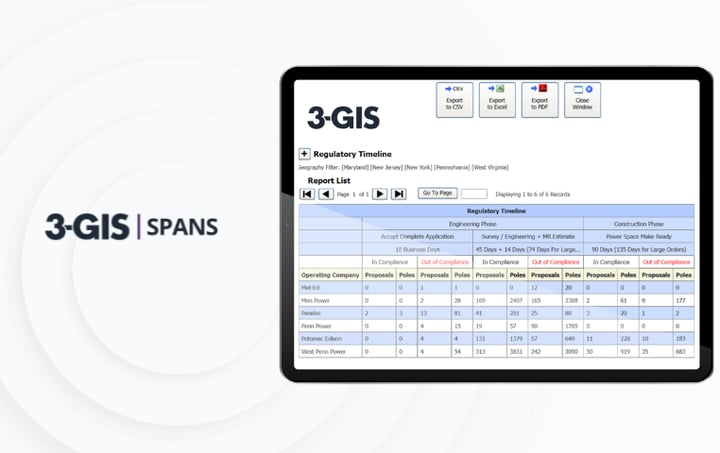
Audit readiness
Maintain documentation, reporting, communication history, policy enforcement, and audit trails that support compliance and dispute readiness.
Revenue visibility
Identify gaps between recorded, permitted, billed, and field-observed attachments to support revenue protection and recovery.
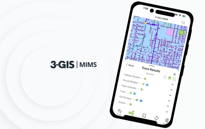
3-GIS | MIMS
Capture mobile field inspections, asset updates, photos, notes, and documentation to provide useful context for pole, attachment, and joint use activity.

3-GIS | Lifecycle
Manage the planning, scheduling, execution, and closeout of operational work related to inspections, make-ready needs, compliance requirements, and infrastructure changes.

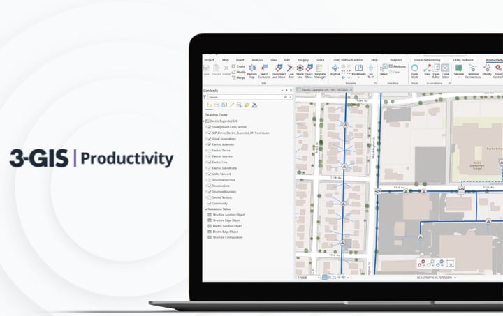
3-GIS | Productivity
Strengthen the Utility Network data behind joint use workflows with tools built for cleaner edits, stronger validation, and more consistent asset records.

Keep exploring
Learn more about joint use management, utility workflows, pole attachment tracking, and the 3-GIS utilities portfolio through related product and educational resources.