Joint use management
Bring clarity to pole attachments
Manage joint use workflows with more structure, transparency, and control. From attachment requests and permits to make-ready coordination, documentation, communications, and billing support, our joint use management solutions make it easier for electric utilities and pole owners to track, defend, and act on pole attachment records with less manual effort.
Joint use management at a glance.
3-GIS joint use management solutions give electric utilities and pole owners that manage telecom and broadband attachments clearer workflows, better records, stronger accountability, and more audit-ready documentation. The connected software replaces scattered emails, spreadsheets, PDFs, and manual status updates with a more organized process for requests, approvals, make-ready work, communications, disputes, and billing support.
Supporting connected workflows
Manage the full pole attachment process
Joint use management involves many teams, records, approvals, and handoffs. 3-GIS enables utilities and pole owners to bring those moving parts into a more structured workflow, so each request is easier to track from intake through documentation and closeout.
Attachment requests
Accelerate the intake, review, approval, and tracking of telecom and broadband pole attachment requests in a more organized workflow.
Permits & agreements
Handle joint use permits, agreement details, supporting documents, communications, and related records with greater consistency.
Make-ready coordination
Track work, dependencies, next steps, ownership, and status updates tied to preparing poles for telecom or broadband attachments.
Stakeholder communication
Give utilities, attachers, contractors, and engineering teams a clearer way to follow activity and responsibilities.
Audit-ready records
Maintain documented history for approvals, communications, disputes, inspections, attachment activity, and compliance support.
Billing support
Improve confidence in attachment records, agreement data, rental billing inputs, cost recovery, and revenue-related workflows.
Why 3-GIS
Less manual effort. More control.
When attachment workflows are scattered across email, spreadsheets, portals, PDFs, and shared drives, it becomes harder to track status, enforce accountability, and defend decisions. With 3-GIS, teams build a clearer operational record.
Clearer visibility
See where requests stand, who owns the next step, what documentation exists, and which records still need attention.
Reduce administrative burden
Cut down on manual status updates, duplicate tracking, disconnected files, and time-consuming coordination between internal and external teams.
Stronger defensibility
Strengthen compliance, audits, disputes, inspections, and internal reviews with more complete records and documented workflow history.
Better revenue confidence
Improve the attachment and agreement records needed to support rental billing, cost recovery, and missed revenue identification.

Who this is for
Built for pole attachment stakeholders
Joint use workflows affect more than one department or organization. With 3-GIS, each stakeholder works from a clearer view of requests, records, responsibilities, and next steps.
Pole owners
Give electric utilities, cooperatives, municipalities, and other pole owners a more accountable process for attachment requests, records, permits, and billing support.
Telecom teams
Simplify processes for telecom, broadband, and fiber attachers requesting access, tracking status, responding to requirements, and coordinating next steps.
Make-ready teams
Empower engineering and make-ready teams with clearer task ownership, status visibility, documentation, and coordination around pole preparation and follow-up work.
Risk & records
Have compliance, legal, billing, and operations stakeholders maintain stronger records for audits, disputes, deadlines, policies, and attachment-related revenue workflows.
Connected utility solutions
Powering joint use management
Explore how 3-GIS improves visibility across network management, field operations, work management, and joint use workflows.
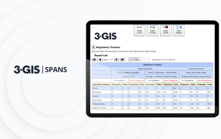
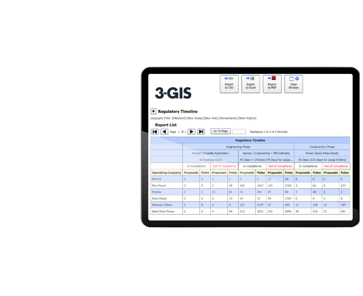
3-GIS | SPANS
Joint use and third-party attachment management
3-GIS | SPANS makes it easier for pole owners to manage attachment requests, permitting workflows, pole and span records, communications, compliance documentation, audit trails, and revenue-related attachment data.
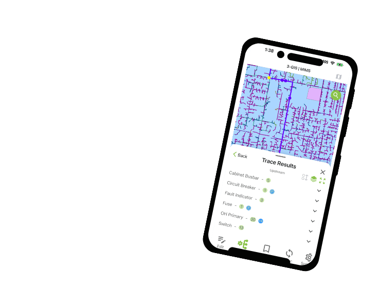
3-GIS | MIMS
Mobile inspection and field documentation
3-GIS | MIMS connects utility field workflows with mobile GIS access, inspections, photos, notes, and asset updates that may help inform pole attachment and infrastructure records.
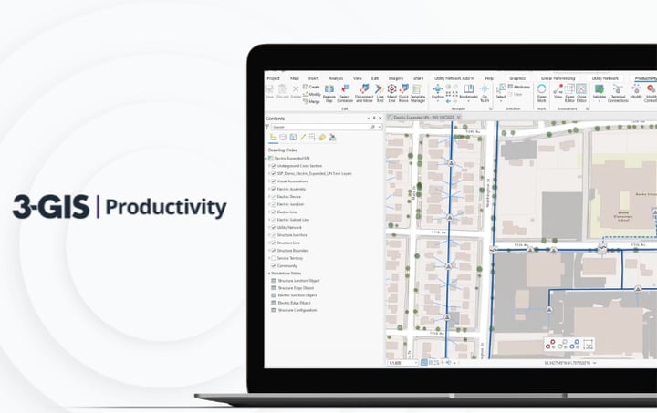
3-GIS | Lifecycle
Operational visibility and work management
3-GIS | Lifecycle ensures smooth operational work management when inspections, make-ready needs, maintenance activity, or infrastructure changes need to move through planning, scheduling, execution, and closeout.
Joint use management FAQs
-
What is joint use management?
Joint use management is the process of managing third-party access to pole infrastructure, including attachment requests, permits, agreements, make-ready work, communications, documentation, compliance records, and billing support. For electric utilities and pole owners, it ensures telecom and broadband attachments are properly reviewed, tracked, documented, and managed.
-
Who needs joint use management software?
Joint use management software is useful for electric utilities, pole owners, municipalities, cooperatives, telecom providers, broadband operators, fiber attachers, contractors, engineering teams, permitting teams, compliance teams, and billing stakeholders involved in pole attachment workflows..
-
What joint use management problems does 3-GIS solve?
With 3-GIS, teams can replace scattered emails, spreadsheets, PDFs, portals, shared drives, and manual status updates with more structured workflows. This improves visibility into request status, documentation, ownership, make-ready activity, disputes, compliance needs, and attachment-related records.
-
How does 3-GIS support billing?
Better joint use records make it easier for utilities to maintain clearer information about attachments, agreements, rentals, ownership, and related activity. This ensures more reliable billing inputs, cost recovery, revenue confidence, and identification of potential attachment record gaps.
-
Which 3-GIS product supports joint use management?
3-GIS | SPANS is the primary product for joint use management. SPANS allows organizations to manage attachment requests, permitting workflows, communications, pole and span records, documentation, compliance support, and revenue-related attachment data.
Keep exploring
Explore related utility resources, product information, and solution content for joint use management, field workflows, operational visibility, and utility GIS.