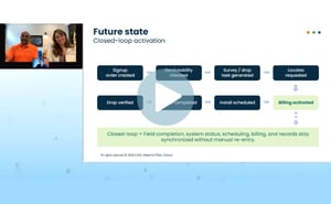
How Waterloo Fiber redefined speed and accuracy
Faster installs depend on more than speed. Watch how connected orders, field work, and network records keeps Waterloo Fiber moving from request to activation.
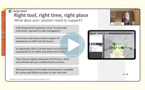
Turning inspections into action
Inspection findings should not sit in reports. Watch how Modesto Irrigation District moves field findings into repair assignments teams can act on.
Telecom | Webinar
Adding context to connectivity in Esri’s Telecom Domain Network
Understanding how a fiber network is connected is essential. But connectivity alone doesn't tell you how much capacity remains, where resources are being utilized, or how changes to one part of the network could affect another.
Esri's Telecom Domain Network establishes a standardized foundation for managing shared network assets in the same environment as fiber connectivity, but realizing its full potential requires additional context. With the upcoming Q1 2027 release of 3-GIS | Web, telecom teams will have new ways to evaluate network capacity, utilization, and dependencies within the Telecom Domain Network.
Join the 3-GIS product team Tuesday, November 10, at 9:00 AM CST for a closer look at how 3-GIS | Web extends the value of Telecom Domain Network data beyond physical connectivity. Building on our previous demonstration, we'll explore additional capabilities for evaluating network capacity, utilization, and dependencies.
In this session, we’ll cover:
-
How connectivity data provides context for understanding network capacity and utilization
-
Ways to identify available resources and potential constraints within the fiber network
-
A new tracing capability for examining capacity and downstream network impact
-
What these capabilities mean for organizations evaluating the Telecom Domain Network
Whether you're exploring the Telecom Domain Network for the first time or following its development, this session offers a closer look at the network insight possible when information about connectivity and capacity come together.
Please complete the form to register.
About the presenters
Andrew Wright
3-GIS | Director of Product Management
Andrew Wright, Director of Product Management at 3-GIS, leads strategy and development for the company’s telecom product portfolio. With 15 years of GIS experience focused on telecom and fiber networks, Andrew brings a practical understanding of both the product and the customer workflows behind it. His background working directly with 3-GIS customers helps shape product decisions around how teams actually manage, maintain, and use network data.
Scott Beard
3-GIS | Executive Director of Strategic Product Initiatives
Scott has been a part of 3-GIS for over 13 years, working across both product and services. He has led implementation, data, training, and customer support teams, helping organizations get real value from their 3-GIS deployments.
Today, Scott leads a dedicated team focused on extending 3-GIS | Web to support Esri’s Telecom Domain Network, helping organizations successfully adopt this new model.
Dexter Thompson
3-GIS | Sales Engineer III
Dexter has spent eight years at 3-GIS, starting in design services, where he focused primarily on network design. After that, he transitioned into support for five years, troubleshooting issues, guiding customers through 3-GIS workflows, and serving as the lead trainer. Now, he helps companies navigate the challenges of network asset management, drawing on his deep technical expertise to find smarter, more efficient solutions.
© Copyright 2026 3-GIS