
.webp?width=1170&height=796&name=Telecom_Overview_hero%20(1).webp)

![]()
Trusted network records
Maintain a more accurate view of fiber, copper, ducts, equipment, structures, connectivity, field updates, and operational network data.
![]()
Network connectivity
Understand how network assets connect, serve customers, support capacity, and affect downstream workflows across the business.
![]()
Lifecycle continuity
Carry network data from planning and design into construction, as-builts, field operations, maintenance, and long-term management.
![]()
Office-field alignment
Reduce disconnects between design intent, contractor execution, field verification, as-built updates, and the system of record.
![]()
Configurable governance
Control workflows, roles, permissions, data visibility, and user experiences as teams, vendors, and business needs evolve.
![]()
Enterprise-scale growth
Strengthen growing, complex, multi-region telecom networks with better visibility, data governance, and operational decision-making.
.webp?width=1170&height=608&name=Telecom_Overview_hover_swap_module_Plan%20(1).webp)
.webp?width=1170&height=608&name=Telecom_Overview_hover_swap_module_Inventory%20(1).webp)
.webp?width=1170&height=608&name=Telecom_Overview_hover_swap_module_Build%20(1).webp)
.webp?width=1170&height=608&name=Telecom_Overview_hover_swap_module_Operate%20(1).webp)
3-GIS | Web
Core network management platform
3-GIS | Web is the central platform for telecom network design, management, analysis, documentation, connectivity, and operational visibility. It is the foundation for the connected 3-GIS telecom ecosystem.

3-GIS | Mobile
Field access and updates
3-GIS | Mobile extends network data into the field, enabling teams to capture updates, verify assets, document as-builts, attach photos, redline changes, and keep field activity connected to Web.

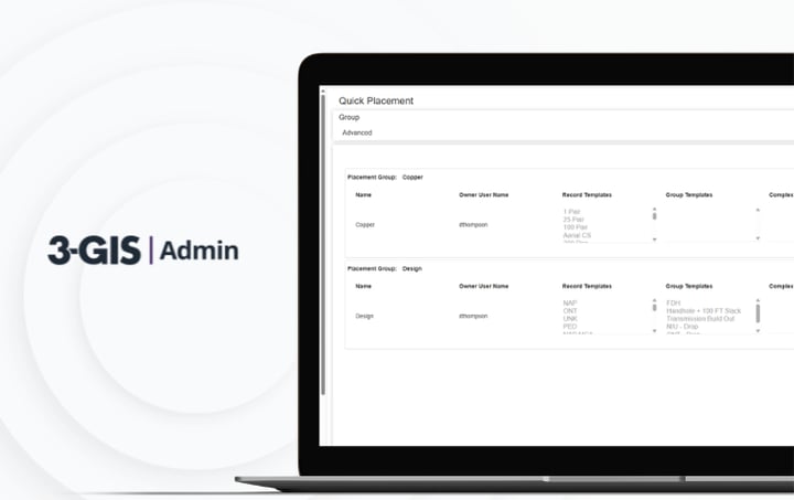
3-GIS | Admin
Configuration and governance
3-GIS | Admin manages roles, permissions, data visibility, contractor access, workflow configuration, QA/QC rules, and system governance across the 3-GIS telecom environment.

3-GIS | Diagramming
Dynamic diagram generation
3-GIS | Diagramming provides exportable visualizations of complex fiber connectivity, including strand-level detail, equipment relationships, and splicing context.

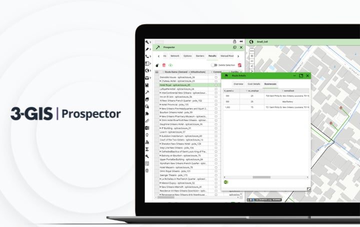
3-GIS | Prospector
Automated planning analysis
3-GIS | Prospector drives early planning by allowing teams to evaluate market opportunities, routes, customers, service areas, and expansion strategies before detailed design begins.

Keep exploring
Explore telecom resources, product information, webinars, customer stories, and solution content for fiber planning, network records, field workflows, and operations.